Text
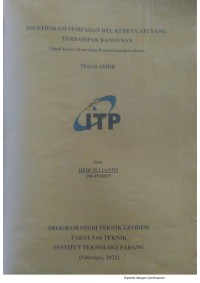
Identifikasi Sempadan Rel Kereta Api yang Terdampak Bangunan
ABSTRACT
The increase in urban areas resulted in the need for urban facilities and infrastructure to increase. The high flow of urbanization makes an already dense city even more congested. The increase in population causes the need for housing and the demand for residential land to increase, which in turn will have an impact on increasing the value of a residential land.
Development in the railroad border areas has been regulated by the government as stated in Law number 23 of 2007 concerning railroads, in the regulation it is stated that the border is the axle line on the left and right of the rail which is set as the limit for protecting the railroad, therefore, construction in the railway area is prohibited under certain conditions. Therefore, the city of Solok was chosen as the research site, because the development of this building occurred a lot on the railway border of the city of Solok. The railroad border area is an area along the railroad track which is limited by the outer boundary of rumija (road property) and rumaja (road use space).
The identification of the Solok City railroad border that was affected by the building passed through two sub-districts, namely Tanjung Harapan District and Lubuk Sikarah District. The method used is processing shp data for measuring railroad tracks and building shp then buffering from axles 6-12meters left and right, then the clips method is used to find the area of the building that is included in the rail border, then the results are 184 total buildings affected by the railroad border with a total building area. of 23387,023 m² and the building that was cut off by the rail border was 12325,401 m²
Keywords: Geographic Information System, Railroad Border, Buffering.
Ketersediaan
Informasi Detail
- Judul Seri
-
Tugas Akhir Teknik Geodesi Sarjana
- No. Panggil
-
2251-001
- Penerbit
- Padang : Fakultas Teknik ITP., 2022
- Deskripsi Fisik
-
-
- Bahasa
-
Indonesia
- ISBN/ISSN
-
2014510025
- Klasifikasi
-
NONE
- Tipe Isi
-
text
- Tipe Media
-
computer
- Tipe Pembawa
-
-
- Edisi
-
-
- Subjek
-
-
- Info Detail Spesifik
-
-
- Pernyataan Tanggungjawab
-
Dedi Julianto
Informasi Lainnya
- NIM
-
-
Versi lain/terkait
Tidak tersedia versi lain
Lampiran Berkas
Komentar
Anda harus masuk sebelum memberikan komentar
 Karya Umum
  Filsafat
  Agama
Agama  Ilmu-ilmu Sosial
  Bahasa
  Ilmu-ilmu Murni
  Ilmu-ilmu Terapan
  Kesenian, Hiburan, dan Olahraga
  Kesusastraan
  Geografi dan Sejarah