Text
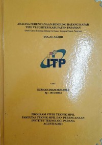
Analisa Perencanaan Bendung Batang Kapar Tipe Vlughter Kabupaten Pasaman (Studi Kasus Bendung Batang Air Kapar, Simpang Empat, Pasaman)
ABSTRACT
Rivers are a source of human life, for example, they are used for raw water sources, irrigation needs and natural drainage, or they can be used for hydropower, shipping, fisheries and industry. The first step in the planning of the weir is the hydrological analysis to determine the discharge of flood plan where the rainfall consists of three rainfall recording stations which are precipitation stations DAS Pasaman, with rainfall stations for 11 years from 2009 to 2019. The results of the planned flood discharge analysis are then used for hydraulic and structural analysis of the weir which includes planning the dimensions of the weir, stilling pond crest, and the front floor of the weir. After the hydraulic design of the weir, the stability of the weir is controlled against overturning, shearing, eccentricity and subsidence. The area of the river watershed is 232.73 km2, the length of the main river is ±23.45 km. By calculating the planned flood discharge using the Weduwen and Hasper method, it is obtained that the planned flood discharge with a return period of Q50 years is 668.44 m3 /sec. Based on the results of the analysis and hydraulic planning of the Batang Kapar weir, namely a fixed weir with a weir height (P) of 2.50 m, a total weir width of 40 m, 2 drain doors, a round lighthouse type, a Vlughter stilling pool with a length of 7.5 m and a floor length. front weir 12 m. The stability of the Batang Kapar weir can be declared safe against shear forces, eccentricity, overturning and subsidence.
Ketersediaan
Informasi Detail
- Judul Seri
-
Tugas Akhir Teknik Sipil Sarjana
- No. Panggil
-
2221-007
- Penerbit
- Padang : Fakultas Teknik ITP., 2021
- Deskripsi Fisik
-
-
- Bahasa
-
Indonesia
- ISBN/ISSN
-
2014210064
- Klasifikasi
-
NONE
- Tipe Isi
-
text
- Tipe Media
-
computer
- Tipe Pembawa
-
-
- Edisi
-
-
- Subjek
-
-
- Info Detail Spesifik
-
-
- Pernyataan Tanggungjawab
-
Nurman Imam Moharry
Informasi Lainnya
- NIM
-
-
Versi lain/terkait
Tidak tersedia versi lain
Lampiran Berkas
Komentar
Anda harus masuk sebelum memberikan komentar
 Karya Umum
  Filsafat
  Agama
Agama  Ilmu-ilmu Sosial
  Bahasa
  Ilmu-ilmu Murni
  Ilmu-ilmu Terapan
  Kesenian, Hiburan, dan Olahraga
  Kesusastraan
  Geografi dan Sejarah