Text
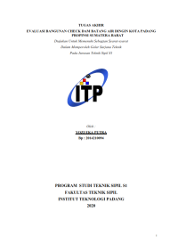
Evaluasi Bangunan Check Dam Batang Air Dingin Kota Padang Provinsi Sumatera Barat (Studi kasus Batang Aia Dingin, Lubuk Minturun)
As a result of excavation C on the cold water stem which causes riverbanks to be prone to landslides, so that the sediment carried and the sediment entering the river flow Batang Kuranji flash floods that happens, with the amount of sediment produced by excavation C avalanche, it is necessary to build a sediment control building (check dam) to overcome the problem of decreasing the river bed (degradasi). Rainfall is obtained from topographic maps and Mount Nago stations, stone rotten station and mount Sarik station from 2006 to 2015. From the hydrolytic analysis the rainfall plan was obtained using the Gumbel method, log person III method and Normal log. The flood discharge plan for the 100-year return period is used in the weduwen method (Q100th) 363,400m3 /dtk. The check dam building is planned for an overflow type (head work) with high check dam 4 m. Body slope upstream 10 : 8, height sub dam 1 m, apron length 15 m, thick apron floor 1.6 m,
with estimated volume of sediment flow that can be accommodated 120.15 m³ / once flood. The stability of check dam construction is calculated against bolsters with safety coefficient =1.5 1.2, sliding 1.7 1.2, so that the check dam construction is stable and the river bed is stable
against degradation.
Ketersediaan
Informasi Detail
- Judul Seri
-
Tugas Akhir Teknik Sipil
- No. Panggil
-
2021-046
- Penerbit
- Padang : Fakultas Teknik ITP., 2020
- Deskripsi Fisik
-
-
- Bahasa
-
Indonesia
- ISBN/ISSN
-
2014210094
- Klasifikasi
-
NONE
- Tipe Isi
-
text
- Tipe Media
-
computer
- Tipe Pembawa
-
other (computer)
- Edisi
-
2020.1
- Subjek
-
-
- Info Detail Spesifik
-
-
- Pernyataan Tanggungjawab
-
Yozi Eka Putra
Informasi Lainnya
- NIM
-
-
Versi lain/terkait
Tidak tersedia versi lain
Lampiran Berkas
Komentar
Anda harus masuk sebelum memberikan komentar
 Karya Umum
  Filsafat
  Agama
Agama  Ilmu-ilmu Sosial
  Bahasa
  Ilmu-ilmu Murni
  Ilmu-ilmu Terapan
  Kesenian, Hiburan, dan Olahraga
  Kesusastraan
  Geografi dan Sejarah